Advancements in Weather Forecasting Technologies Revolutionizing Meteorology
Discover how innovative weather prediction technologies like Doppler radars, radiosondes, and satellites are revolutionizing meteorology. These systems improve forecast accuracy, enabling early warnings for severe weather events, safeguarding communities worldwide. The article explores key tools shaping the future of weather forecasting, emphasizing the importance of integrated data systems for reliable predictions and disaster preparedness.
How Modern Technologies Are Enhancing Weather Prediction Accuracy
In an era marked by increasingly unpredictable climate patterns, the importance of accurate and timely weather forecasting cannot be overstated. Recent technological innovations in meteorology are transforming how scientists monitor, analyze, and predict atmospheric conditions. This comprehensive overview explores the most impactful tools and systems that have reshaped weather prediction, making forecasts more reliable and enabling proactive responses to severe weather events. From space-based satellites to sophisticated ground-based systems, these advancements provide critical insights that safeguard communities and enhance disaster preparedness.
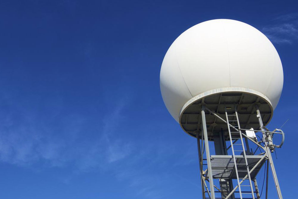
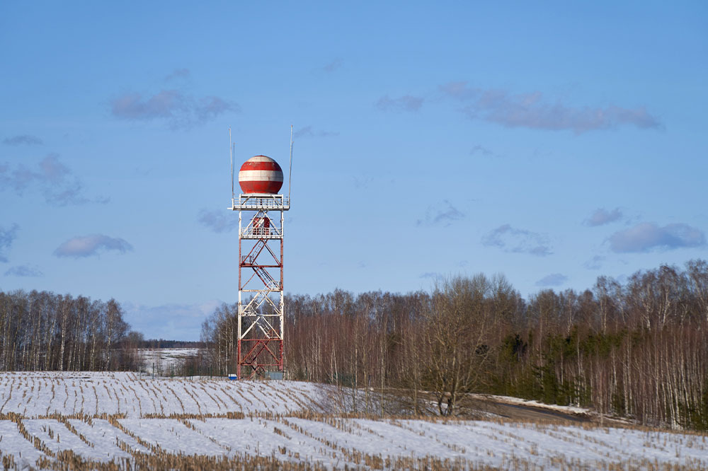
Doppler Radars
Doppler radar technology has become a cornerstone in modern meteorology due to its capacity to detect and analyze atmospheric phenomena with remarkable precision. By emitting radio waves that bounce off precipitation particles and atmospheric targets, Doppler radars generate detailed images that reveal the intensity, location, and movement of weather systems. The Doppler effect—changes in wave frequency—allows meteorologists to measure velocity and direction of storm movements, essential for tracking severe weather such as thunderstorms, tornadoes, and hurricanes. Nationwide, a dense network of over 150 Doppler radar stations ensures continuous, real-time surveillance, significantly improving early warnings and emergency response planning. This technology not only enhances our understanding of storm development but also helps in predicting rainfall patterns, floods, and wind shear effects with greater confidence.
Radiosondes
Radiosondes are sophisticated instruments attached to weather balloons that ascend through the atmosphere, collecting vital data at various altitudes. These lightweight sensors transmit continuous measurements of temperature, humidity, air pressure, wind speed, and wind direction back to ground stations via radio signals. Capable of reaching heights up to 115,000 feet, radiosondes unlock invaluable insights into upper atmospheric layers that are otherwise difficult to monitor. The data obtained from these balloon launches are crucial for refining weather models, especially for forecasting long-term weather patterns and tracking storm development. Annually, thousands of radiosonde launches help meteorologists understand atmospheric dynamics, leading to more accurate predictions and risk assessments in different regions. This technique is particularly significant for understanding jet streams, temperature gradients, and moisture transport, which directly influence weather formation globally.
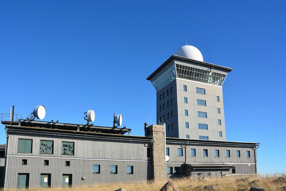
Automated Surface Observing Systems (ASOS)
Complementing radar and balloon data, ground-based Automated Surface Observing Systems (ASOS) stations continuously monitor local weather conditions on the Earth's surface. These systems collect real-time data on variables such as cloud cover, wind speed and direction, atmospheric pressure, temperature, and precipitation. Managed through collaborations between meteorological agencies, aviation authorities, and emergency services, ASOS stations operate 24/7 to ensure a comprehensive and up-to-date picture of local weather environments. They are instrumental in detecting localized phenomena like fog, haze, thunderstorms, and sudden storms, providing detailed situational awareness for safety, aviation, agriculture, and disaster management. The widespread deployment of ASOS ensures regional and even localized forecasting capabilities, supporting more precise weather alerts and timely public warnings.
Advanced Weather Processing Systems (AWIPS)
The raw data collected from Doppler radars, radiosondes, and surface stations are aggregated and analyzed through sophisticated systems like the Advanced Weather Processing System (AWIPS). As a centralized platform, AWIPS integrates multiple data streams, applying complex algorithms and atmospheric models to generate comprehensive forecasts. It synthesizes satellite imagery, ground observations, and numerical weather prediction outputs to produce detailed, high-resolution weather maps and predictions. The system's ability to unify diverse datasets facilitates seamless information sharing among meteorological centers worldwide, leading to accelerated decision-making and improved forecast accuracy. AWIPS also plays a pivotal role in issuing early warnings for extreme weather events, enabling authorities to prepare for hurricanes, cyclones, and other disasters well in advance. The development of such integrated systems reflects the ongoing evolution toward data-driven meteorology, where big data analytics and machine learning enhance predictive capabilities.
Weather Satellites
Orbiting high above the Earth, weather satellites provide continuous, high-resolution imagery and atmospheric data vital for global weather monitoring. Traveling at speeds of roughly 22,000 miles per hour, these satellites complete an orbit around the planet approximately every 30 minutes, offering a near-constant stream of updates. They capture detailed images of cloud formations, moisture distribution, and surface temperature, allowing meteorologists to observe storm development from space. Satellite data is invaluable for tracking large-scale weather systems, monitoring climate change indicators, and understanding the dynamics of atmospheric water vapor and cloud cover. Geostationary satellites provide real-time, fixed-location coverage of specific regions, while polar-orbiting satellites supply global coverage with high detail. These space-based assets enable early detection of developing severe weather, such as cyclones and monsoons, and support long-term climate monitoring efforts. Their role in modern meteorology is indispensable, providing a global perspective that complements ground-based observations.
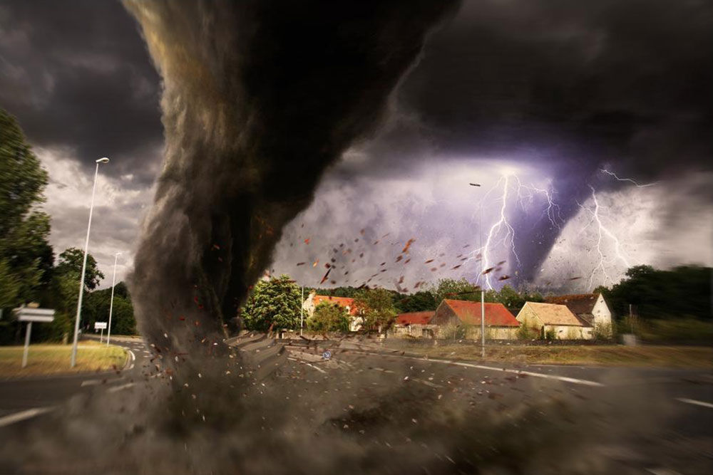
Integrating these cutting-edge technologies allows meteorologists worldwide to detect even subtle atmospheric shifts with high precision. Early warnings derived from these systems have saved countless lives by enabling authorities to prepare for and respond to extreme weather events such as hurricanes, thunderstorms, tornadoes, and floods. By leveraging advanced data collection, processing, and satellite imagery, forecasting accuracy has significantly improved, ensuring safer communities and better disaster management strategies. As technology continues to advance, the future of weather prediction promises even greater reliability and timeliness, ultimately helping humanity adapt more effectively to an ever-changing climate landscape.