Comprehensive Guide to the Three Primary Types of Satellite Imaging Technology
This comprehensive article explores the three main types of satellite imagery: visible light, infrared, and water vapor imaging. It details how these technologies work, their applications in environmental monitoring, weather forecasting, agriculture, and defense, and highlights the evolution of satellite imaging from early missions to modern, real-time data systems. Perfect for understanding remote sensing, this guide emphasizes the importance and versatility of satellite technology in our daily lives and scientific pursuits.
Comprehensive Guide to the Three Primary Types of Satellite Imaging Technology
Satellite imaging, often referred to as remote sensing technology, plays a crucial role in Earth observation by capturing detailed images of the planet's surface from space. This technology involves the use of satellites and aircraft equipped with specialized sensors that detect electromagnetic radiation (EMR) reflected or emitted by the Earth's features. These images provide invaluable insights for various applications, including environmental monitoring, disaster management, agriculture, urban planning, and scientific research. As technology advances, diverse satellite sensors can detect different wavelengths of EMR—such as infrared, ultraviolet, and microwave—each revealing unique aspects of our planet.
The electromagnetic spectrum (EM spectrum) encompasses all types of electromagnetic radiation, but human eyes are only capable of perceiving a small portion—the visible light spectrum. Satellite sensors extend beyond visible light, capturing images in wavelengths invisible to the naked eye. To make these images comprehensible, they are often represented with artificially assigned colors. This enables scientists and analysts to interpret data that would otherwise remain hidden, such as subtle changes in vegetation health, soil moisture, or atmospheric conditions.
Satellite images frequently display surreal, colorful representations—often unlike traditional photographs. These vibrant visuals are the result of false-color imaging, which assigns specific wavelengths to visible colors, enhancing the contrast between various surface and atmospheric features. For example, high infrared reflectance from healthy vegetation is depicted as bright red in some images, providing a clear indication of plant vigor. This technique is vital for remote sensing applications, allowing users to quickly assess environmental conditions and monitor dynamic processes across the globe.
Satellite images often feature otherworldly colors, creating striking visual representations.
Real-Time Satellite Monitoring
One of the most valuable aspects of satellite imagery is the ability to perform real-time or near-real-time monitoring of Earth's surface. Different materials and surfaces reflect electromagnetic radiation uniquely, enabling satellites to distinguish between various objects from space. For instance, paved surfaces like roads and buildings reflect most energy through a process called specular reflection, resulting in bright, easily detectable images. In contrast, natural surfaces, such as forests and water bodies, scatter energy in many directions—a process termed diffuse reflection—allowing detailed analysis of vegetation density, forest health, and water quality.
With advancements in satellite technology, we now have the capability to observe changes and phenomena as they occur. Platforms such as Google Earth and specialized remote sensing systems provide continuous updates, facilitating critical applications like disaster response, weather forecasting, and land management. The electromagnetic wavelengths employed in satellite imaging—for example, infrared—are particularly effective for assessing specific features. Infrared radiation, which is emitted by all objects warmer than absolute zero, is especially useful for evaluating plant health. Healthy foliage reflects more infrared light, whereas stressed or diseased plants reflect less, enabling precise agricultural monitoring.
Satellite imagery supports an array of critical functions, including weather prediction, cartography, military surveillance, environmental assessment, and scientific exploration. Over time, the resolution and accessibility of satellite data have vastly improved. Modern satellites orbit Earth constantly, capturing high-resolution images that are accessible promptly worldwide. These images are invaluable for researchers, policymakers, and industries worldwide, helping drive informed decision-making. Many organizations, such as NASA, ESA, and private companies, offer free or licensed access to satellite imagery, broadening its impact and utility.
There are three primary categories of satellite images, each suited to different tasks and conditions:
Visible Light Imagery
This type of imaging closely resembles standard photographs captured with regular cameras. It relies on sunlight reflected off Earth's surface, which means it is limited to daylight hours and clear weather conditions. The images depict natural colors, with lighter surfaces reflecting more light and appearing brighter—examples include snow, deserts, and urban areas. Differentiating snow from clouds can sometimes be challenging since both can appear white, but analyzing temporal image sequences helps clarify the distinction. These images are widely used in mapping, urban planning, and general land cover classification.
Infrared Imagery
Infrared imaging detects the heat emitted by objects, irrespective of external lighting conditions. This allows for 24-hour imaging capabilities, including during night-time or in darkness. Infrared sensors capture radiation emitted by surfaces, making it highly effective for assessing vegetation health, soil moisture content, and thermal anomalies. For agriculture, infrared imagery enables precise monitoring of crop vigor, identifying areas needing irrigation or pest control. However, clouds and fog can sometimes resemble the Earth's surface in infrared images since they are also cold and emit similar radiation, which can sometimes complicate interpretation. Combining infrared data with visible images enhances accuracy and provides a comprehensive view of environmental conditions.
Water Vapor Imaging
This specialized form of satellite imaging measures atmospheric humidity by detecting water vapor concentrations at different altitudes. It provides critical data for weather prediction and climate studies. Water vapor images use color-coded displays to indicate humidity levels—drier regions appear in different shades compared to moist areas. By understanding atmospheric moisture distribution, meteorologists can improve forecasts for storms, hurricanes, and other weather phenomena. This type of imaging is less common but essential for comprehensive atmospheric analysis, especially when combined with other satellite data.
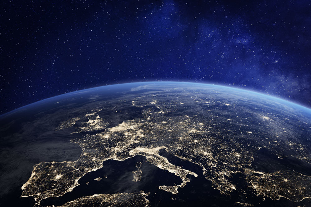
Historically, the journey of Earth observation from space began with pioneering missions like Explorer 6 launched in 1959, which was the first satellite to photograph Earth. Its primary focus was on studying the ionosphere and magnetic fields, but it also captured cloud patterns and weather phenomena. Today, satellite images are significantly more detailed, rapid, and accessible. Instant global imaging via satellites revolutionized meteorology, cartography, environmental monitoring, and security operations. Hundreds of satellites now orbit our planet, providing critical data that enhances our understanding of climate change, natural disasters, and urban development. Major agencies like NASA and international organizations offer frequent, high-quality images to the public, researchers, and industry stakeholders, fueling innovations across multiple sectors.